The contentious Liffey cycle route has finally been chosen and the project unveiled. It will run through the heart of Dublin for 10km - that's 5km of cycling route each side of the river - and will cost over €20 million.
The final design and route for the much-debated Liffey cycle route in Dublin has finally been chosen and unveiled by the National Transport Authority.
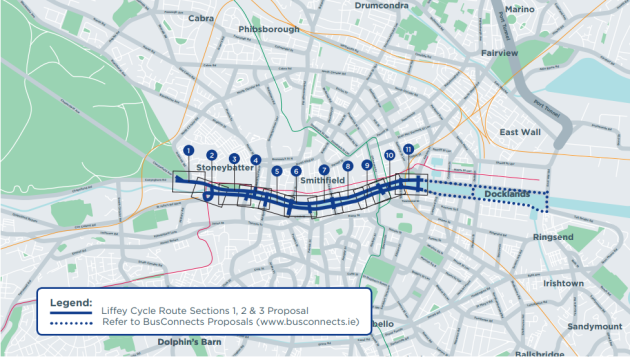
It will stretch for 5km from the Phoenix Park in the west of the city centre, down the quays and west as far as the Tom Clarke East Link Bridge; making a total of 10km of cycleway.
The route, which is set to come in at over €20 million, will run both sides of the river.
It means cyclists will have a segregated cycleway through a section of Dublin that has always been dangerous and intimidating for cyclists.
Advertisement
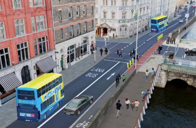
However, the new design is not without its talking points. The most obvious is that the Liffey cycle route will run next to the pavement, across the road from the river bank, for a stretch before switching to the opposite side of the road, running right next to the river.
This is being done so cyclists can avoid a series of bus stops, which are already a hazard the full length of the quays in both directions.
And it means cyclists must cross from one side of the road to the other if they are taking the full length of the cycle route in either direction.
Related News


However, the chosen route and the fact the design has now been unveiled has all been welcomed by the Dublin Cycling Campaign.
The group ran a tireless campaign and got the cycling public behind them. And without the campaigners keeping the pressure on, this project may have slipped from the agenda.
Dublin Cycling Campaign said today the route was very positive for cyclists, bus passengers and pedestrians.
“Dublin Cycling Campaign has been actively campaigning for this iconic route for many years,” the group said.
“It is now wonderful now to see a potentially acceptable design proposal at this stage which has something for all route users.”
The route connects the Point Village to the Phoenix Park on the north side of the river and the East Link Bridge to Heuston Station on the south side.
The 2km western section – closest to Heuston Station and Phoenix Park - will run next to the buildings along the quays.
And the 1.2km central section will run along the river side of the traffic lanes; the switch from one side to the other happening close to O’Donovan Rossa Bridge.
Then the final 1.8km section is a two-way cycleway along the river on both sides; north and south quays.
It will be two metres wide and 3½ metres for the two-way sections. Boardwalks for pedestrians will also need to be installed.
Topics


